San Jose neighborhoods by ZIP code
San Jose is too big for citywide averages to mean much, so start by choosing an area. The city's own divisions are its 10 Council Districts, the planning areas in its planning documents and various neighborhood associations. Names such as Willow Glen and Cambrian are common usage with no legal boundary. The index below lists 16 commonly used areas, followed by photo guides to 10 key San Jose ZIP codes.
Neighborhood index
These names are common usage, not legal boundaries. Links go to the matching ZIP code guide.
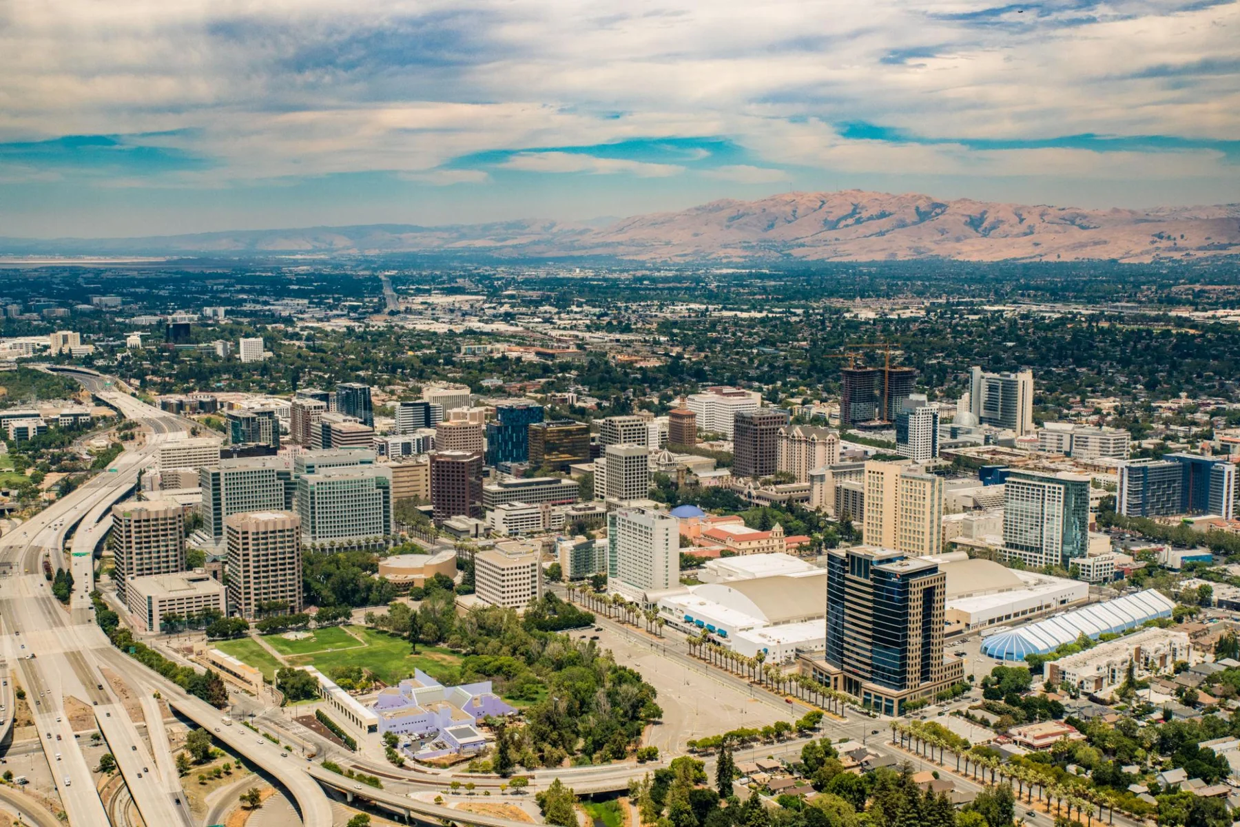
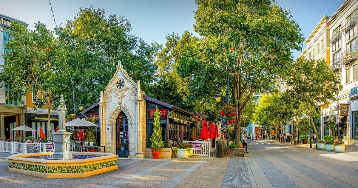
- Downtown (City center): Between SR-87 and Coyote Creek, where high-rise condos mix with older blocks; home to Diridon station and the main library
- Japantown / Northside (North of Downtown): Older blocks north of Downtown with a mix of single-family homes and new apartments, close to North First St light rail
- Rose Garden / Shasta-Hanchett (Central-west): An early residential area west of Downtown, mainly older single-family homes around the Municipal Rose Garden
- Willow Glen (Central-southwest): An established residential area southwest of Downtown, centered on Lincoln Ave, with single-family homes from many eras
- West San Jose (West): Next to Cupertino, Santa Clara and Saratoga, mainly midcentury single-story homes; school districts vary by address
- Cambrian (Southwest): Between SR-85 and SR-17 near Campbell and Los Gatos, with many single-story ranch homes
- Almaden Valley (South valley): A valley south along Almaden Expy, mainly single-family homes on larger lots, backing onto foothill parks; you'll drive for most trips
- Blossom Valley (South): A southern residential area along Blossom Hill Rd, with many postwar single-family homes and townhomes, next to the Oakridge shopping area
- Santa Teresa (Far south): Around the southern end of the Blue Line, backing onto Santa Teresa County Park, near SR-85 and US-101
- Edenvale (South, east side): Between Monterey Rd and US-101, where homes sit next to industrial parks and the south Caltrain line passes through
- Evergreen (Southeast): A southeastern area east of US-101, with many single-family communities from the 1980s on, farther from rail
- Silver Creek (Southeast foothills): In the foothills south of Evergreen, mainly newer single-family homes and planned HOA communities; check hillside issues by address
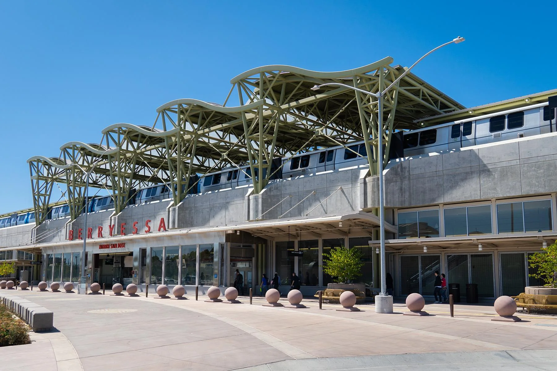
- Berryessa (Northeast): A northeastern area on both sides of I-680, mixing 1960s and 1970s single-family homes with new apartments, with a BART station on its western edge
- North San Jose (North): An office area north of US-101 with light rail along North First St, and housing that's mainly newer condos and townhomes
- Alum Rock / East Foothills (East): From I-680 east to the foothills, where older flatland streets differ greatly from hillside homes; home to Alum Rock Park
- Alviso (Far north, bayfront): A small, low-lying community north of SR-237 beside the bay wetlands; check flood maps first before you buy
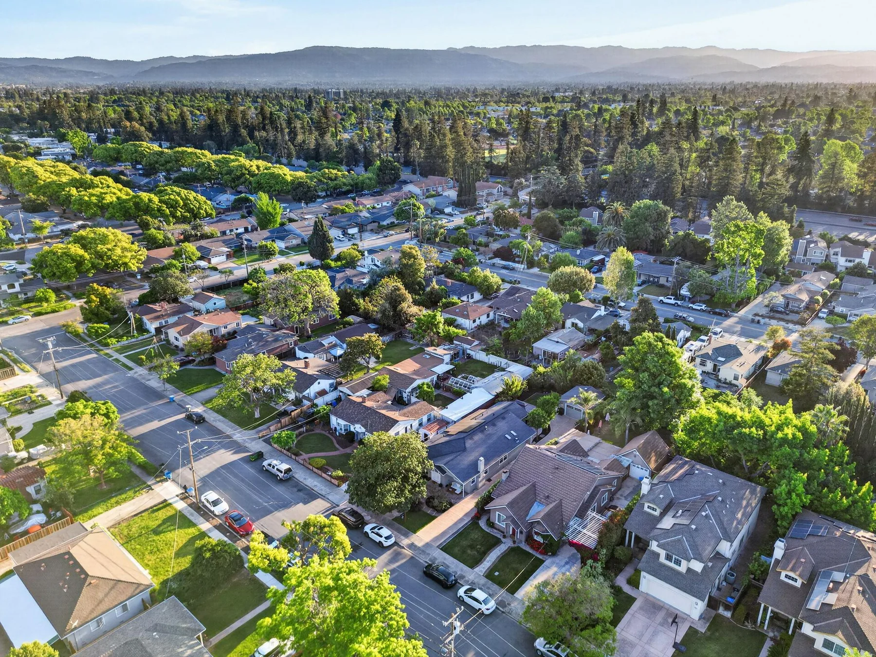
95129 is one of West San Jose’s higher-priced ZIP codes, next to Cupertino, Saratoga and the job centers around Apple, with I-280 along the north and Lawrence Expressway, Saratoga Ave and Bollinger Rd as the everyday roads. Most homes are 1950s and 1960s single-story ranches with three or four bedrooms and two-car garages, many of them remodeled or expanded with a second floor, and condos and townhomes line the main roads. Calabazas Branch Library, Calabazas Park, Rainbow Park and Saratoga Creek Park are all in the area, and shopping runs along Saratoga Ave, De Anza Blvd and Stevens Creek Blvd. Buyers here are usually weighing a combination of location, school assignment, land value and long-term plans rather than square footage alone.
What buyers should know: A 95129 address does not automatically mean Cupertino schools. Elementary, middle and high school districts can change from one street to the next. Two homes of similar size can price very differently because of school boundaries, the lot, room to expand and nearby traffic.
What sellers should know: The ZIP-wide median is not a pricing tool. Start with recent sales inside the same school boundary, with a similar lot, age and level of finish.
Read the full area guide →
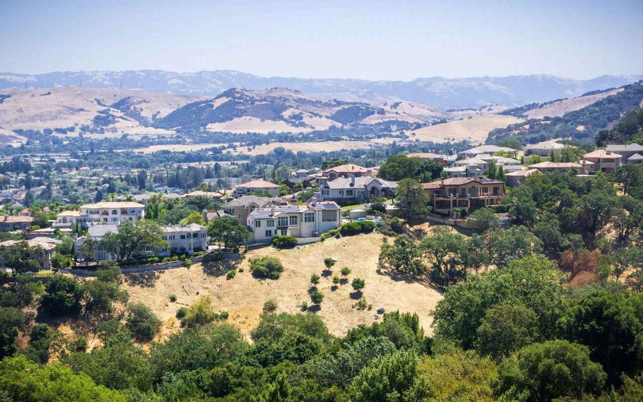
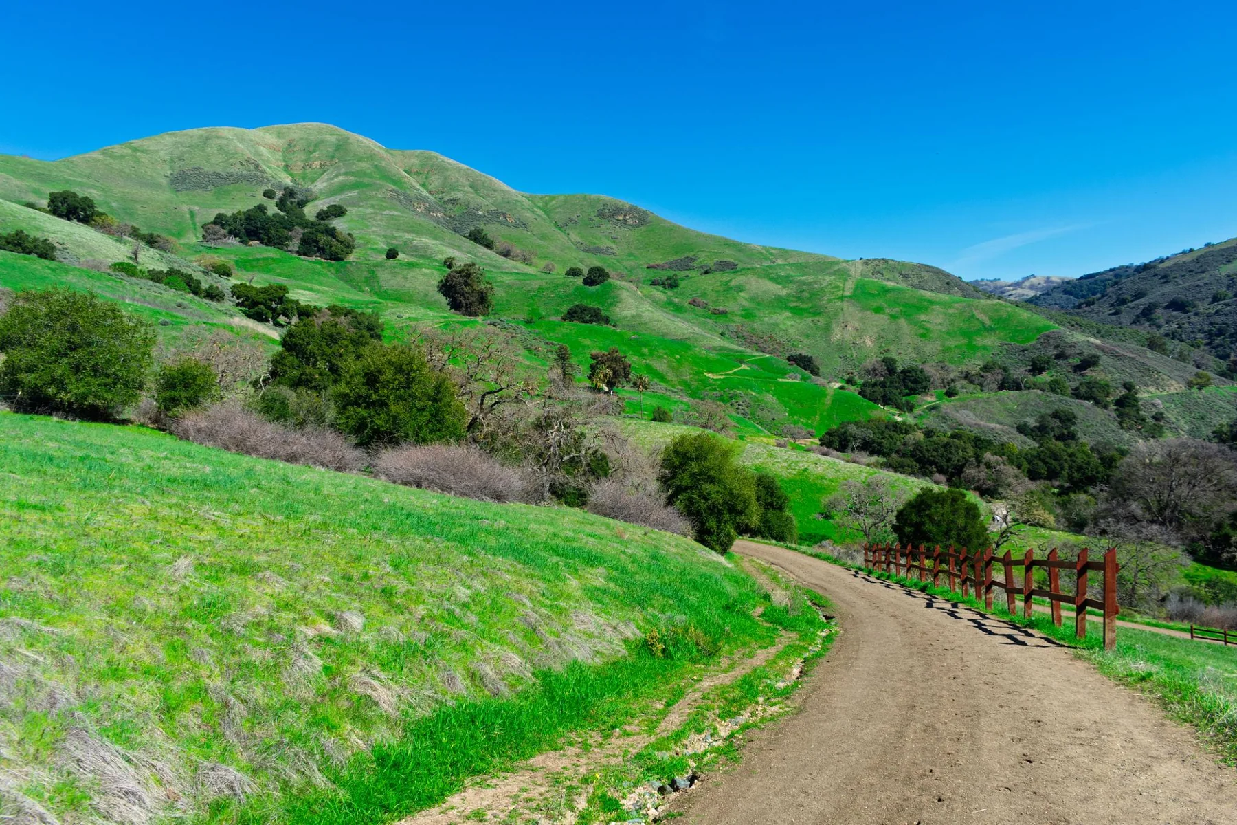
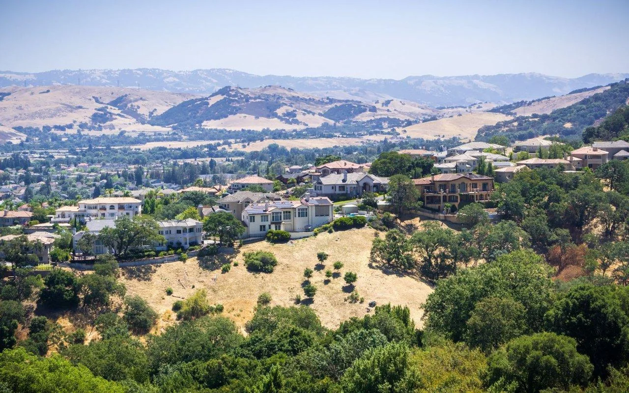
Almaden Valley sits at the south end of San Jose, a valley between the Santa Teresa Hills and the Sierra Azul, near the foothills and open space. Nearly all homes here are single-family, most built from the 1960s to the 1980s, with lots and garages generally roomier than in central neighborhoods. Almaden Lake Park, the Los Alamitos Creek Trail and Almaden Quicksilver County Park are close by, while everyday shopping usually means driving. Buyers tend to focus on home size, yards and the neighborhood setting, and on the commute trade-off to Silicon Valley’s main job centers.
What buyers should know: Check insurance availability, foothill fire risk, drainage, retaining walls, the roof and upkeep costs. Conditions vary a lot by location and property, so the whole ZIP cannot be treated as one risk level.
What sellers should know: Separate standard homes, large-lot properties, view homes and high-end remodels. With few high-end sales, a single month’s median can move simply because of which homes sold.
Read the full area guide →
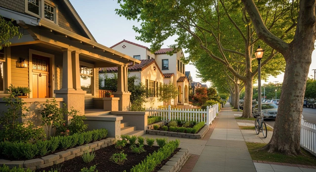
Willow Glen sits southwest of Downtown, roughly between I-280, SR-87 and Los Gatos Creek, and locally the name usually means the older streets on either side of Lincoln Avenue. It is known for established residential streets, homes from many eras, and the shops and restaurants around Lincoln Avenue. Early twentieth-century bungalows, Tudors and Spanish Revival homes stand alongside postwar ranch houses, and that variety between individual homes is the defining feature of this market.
What buyers should know: Within Willow Glen, homes can differ widely in age, lot shape, parking, quality of work and walkability. With older homes, also look at the foundation, drainage, termites, permit history and insurance cost.
What sellers should know: A single price per square foot does not work well here. Historic character, upkeep, outdoor space and proximity to busy streets all need to show up in the pricing analysis.
Read the full area guide →
95124 covers much of the Cambrian area, bordering Campbell and Los Gatos, with SR-85 and SR-17 to the south and west and Camden Ave, Union Ave, Hillsdale Ave and Bascom Ave as the main local roads. These are established low-rise neighborhoods, mostly single-story ranch homes built in tracts in the 1950s and 1960s, typically with three or four bedrooms and two-car garages on regular lots. Cambrian Branch Library, Camden Community Center and Houge Park are spread through the area, Good Samaritan Hospital is on Samaritan Dr, and most errands happen by car. Some parcels are unincorporated county land even though they carry a San Jose mailing address. Buyers usually compare classic single-family homes, yard space, how much updating a home needs, and the commute.
What buyers should know: Look hard at the roof, drainage, plumbing, electrical and foundation, and confirm that any additions were permitted. A new kitchen and floors do not tell you those things. School boundaries inside Cambrian also need checking address by address.
What sellers should know: For classic homes here, a pre-listing inspection, needed repairs, sensible staging and a sharp set of comparable sales usually do more than a general “great schools” pitch.
Read the full area guide →
95118 sits in southwest San Jose between Cambrian and Blossom Valley, with Blossom Hill Rd, Branham Ln and Meridian Ave as the everyday roads and SR-85, SR-87 and Almaden Expressway close by. Most homes are single-story ranches from the 1950s through the 1970s on regular lots, usually with two-car garages, and Blossom Valley adds scattered townhomes from the 1970s and 1980s. Vineland Branch Library is on Blossom Hill Rd, Oakridge to the southeast handles bigger shopping trips, and getting around mostly means driving. What sets this ZIP code apart is that several school districts meet here, so neighborhoods with similar names can fall under different school systems.
What buyers should know: Put schools first on your list. Pioneer High is in San José Unified and Branham High is in Campbell Union HSD, and both campuses are in 95118, while elementary and middle schools here also involve San José Unified, Union School District and others. Confirm the full address with the district rather than relying on a listing. On older ranch homes, look at the original sewer line, single-pane windows, roof, HVAC and permits for additions.
What sellers should know: Group comparable sales by school district first, then by home type and lot. Homes a few blocks apart may belong to different districts, and a 1970s townhome should not sit in the same comparison set as a detached house. Have dates for roof, plumbing and sewer work ready along with permits for additions, and keep school information in the listing to the district and its official lookup.
Read the full area guide →
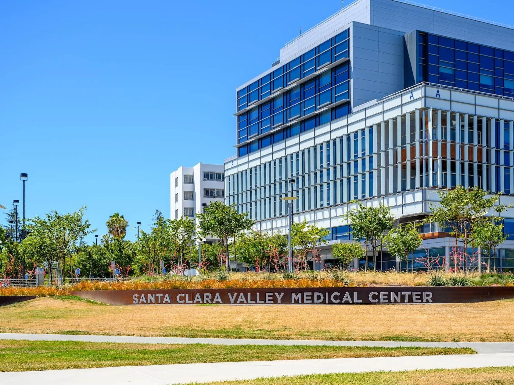
95128 sits between West and Central San Jose, where I-280 meets I-880, with Stevens Creek Blvd, Winchester Blvd and Bascom Ave as the main roads. Santana Row and Westfield Valley Fair are on the north side, and Santa Clara Valley Medical Center and O’Connor Hospital are both in this ZIP code, so shopping and medical care are closer at hand than in most residential areas. Housing is mixed: newer condos around Santana Row, condos and townhomes along the main roads, and mostly single-family homes on the residential streets. With that range, plus pockets of unincorporated county land, comparisons need to go down to the street.
What buyers should know: First confirm whether the address is inside city limits or on county land. Burbank, along Bascom Ave, is an unincorporated community surrounded by San Jose, and permits and services there go through the county. Schools here involve Campbell Union SD, Luther Burbank SD and Campbell Union HSD among others, so confirm the full address with the district. For condos, check the assigned parking, HOA dues, reserves and special assessments. Near Valley Fair and I-280, see the traffic on a weekend and at rush hour.
What sellers should know: Condos, townhomes and single-family homes should not be priced together, and condos near Santana Row belong in a different set from those elsewhere in the ZIP code. Gather permit records from the right agency, county or city, depending on the parcel. The city approved Urban Village plans for Santana Row/Valley Fair, Winchester and Stevens Creek in 2017, so when buyers ask about changes nearby, answer from the city’s published information.
Read the full area guide →
95131 is a key residential part of North San Jose, north of US-101 and mostly between I-880 and I-680, with Berryessa to the east and Milpitas to the north. It has single-family homes, townhomes and condos from different eras, and the newer townhomes and condos usually come with an HOA. Errands and medical visits tend to stay in the area or head to Milpitas, three freeways are close by, and the Berryessa/North San José BART station is not far. It suits buyers comparing the commute to nearby job centers against the cost of keeping a property up.
What buyers should know: With a townhome or condo, price is only part of the comparison. Review HOA dues, reserves, special assessments, insurance responsibilities, rental limits and how well the community is kept up.
What sellers should know: Price by ownership type, size, parking, HOA and sales in the same community. Putting single-family homes and condos in one comparison set can easily mislead.
Read the full area guide →
Rose Garden lies west of Downtown, with The Alameda to the northeast and I-880 to the west. It takes its name from the Municipal Rose Garden at Naglee Ave and Dana Ave, and Shasta-Hanchett forms its eastern half. Homes are mainly from the first half of the twentieth century, and the city’s Hanchett and Hester Park Conservation Area holds a strong mix of Prairie, Spanish Revival and Craftsman houses. Rose Garden Branch Library is on Naglee Ave, the Rosicrucian Egyptian Museum is on Park Ave, and Diridon Station is a short way east. Being close to Downtown and rail is the draw, while older-home upkeep and SJC flight paths are the usual trade-offs.
What buyers should know: On older homes, focus on the foundation and seismic work, old wiring and pipes, the roof, and permits for past additions. One-car or detached garages are common, so see street parking for yourself. If a home is inside the Conservation Area, ask city planning what applies before changing the exterior. Schools here are mainly in San José Unified, whose new boundaries apply to incoming students from 2027–28, so confirm the full address and enrollment year with the district.
What sellers should know: Older houses, condos along the main roads, and newer condos and townhomes near Diridon draw different buyers and price differently, so find comparable sales within each group. Among older homes, the gap usually comes down to structural updates and how much original detail survives, which makes complete records and permits for foundation, wiring and plumbing work valuable. Near Diridon, expect questions about BART Phase II construction and answer them from VTA’s published information.
Read the full area guide →
95132 sits in the northeast corner of San Jose and takes in many of Berryessa’s established neighborhoods, with I-680 running through the middle, the Diablo Range foothills to the east and Milpitas to the north. It offers classic single-family homes and foothill-edge streets. Berryessa Community Center, Berryessa Branch Library, Noble Park and Penitencia Creek Park anchor daily life, and groceries are mostly in the shopping centers along Berryessa Rd, Hostetter Rd and Capitol Ave. Buyers can sort by commute, school boundaries, home size and budget.
What buyers should know: School assignments are not uniform across 95132. Check elementary, middle and high school districts for each address. Homes near the Berryessa/North San José BART station and homes near the foothills also differ in transit, surroundings and construction.
What sellers should know: A 95132 single-family home should not be priced against 95131 townhomes or condos. Use the same home type, lot size, school boundary, level of finish and recent sales.
Read the full area guide →
95135 covers the eastern side of Evergreen in southeast San Jose, against the Diablo Range foothills, with San Felipe Rd and Yerba Buena Rd as the main roads. Most homes are two-story houses from the 1990s and 2000s with plenty of bedrooms and two- or three-car garages, while The Villages is a gated, age-restricted community for residents 55 and over. Evergreen Village Square, Village Square Branch Library, Evergreen Community Center and Evergreen Valley College are all in this ZIP code. There is no freeway or rail station in the area, so trips start on surface arterials out to US-101, and that is the main thing to weigh against the extra space.
What buyers should know: Work out holding costs home by home. Newer neighborhoods may carry HOA dues and CFD or Mello-Roos assessments, and only the tax bill and HOA documents will confirm amounts and end dates. For addresses near the hills, check CAL FIRE hazard zones and the state fault and landslide layers, and get an insurance quote before you offer. The Villages has its own age and community rules, so read the documents before buying. Schools in this area fall under Evergreen School District and East Side Union HSD; confirm the full address with each district.
What sellers should know: Sales here include regular single-family homes and age-restricted communities such as The Villages, so the ZIP-wide median is not a pricing tool, and comparable sales should stay within the same kind of community. Have HOA dues, the annual CFD amount and its end date ready, since buyers will build them into the monthly cost. On hillside lots, the view, driveway slope and insurance picture all belong in the pricing analysis.
Read the full area guide →
Daily life in San Jose
MedicalShoppingDiningParksLibrariesTransit
Medical care | Hospitals and emergency rooms
The city's general hospitals are spread across several directions. The county's Santa Clara Valley Healthcare system has three San Jose hospitals: Santa Clara Valley Medical Center on South Bascom Ave, O'Connor Hospital on Forest Ave, and Regional Medical Center on North Jackson Ave in the east. Regional Medical Center was formerly owned by HCA, and the county took over on April 1, 2025. The hospital's website lists a Level II trauma center and 24-hour emergency care. In the southwest is HCA's Good Samaritan Hospital, and near Santa Teresa at the south end is Kaiser Permanente San Jose Medical Center. Sutter/Palo Alto Medical Foundation and Stanford also have clinics in the South Bay; check their websites for locations and specialties.
What buyers should know: A hospital close to home doesn't mean your insurance covers care there. Kaiser members generally get care within the Kaiser system, and with other plans you'll need to confirm each hospital and doctor is in network. When touring homes, check both routes: home to the nearest ER and home to the clinic you use regularly.
Main hospitals
- Santa Clara Valley Medical Center (Hospital / ER / trauma center): San Jose, 751 S Bascom Ave. County hospital; its website lists emergency, trauma, burn and pediatric services, among others. Official site
- Regional Medical Center (Hospital / ER / trauma center): San Jose, 225 N Jackson Ave. Taken over by the county on April 1, 2025, and now part of Santa Clara Valley Healthcare; Level II trauma center. Official site
- O'Connor Hospital (Hospital / ER): San Jose, 2105 Forest Ave. Part of Santa Clara Valley Healthcare; near Rose Garden and West San Jose. Official site
- Good Samaritan Hospital (Hospital / ER): San Jose, 2425 Samaritan Dr. Near Cambrian and Los Gatos, next to SR-85; its website lists 24-hour emergency care, maternity and a neonatal intensive care unit. Official site
- Kaiser Permanente San Jose Medical Center (Hospital / ER): South San Jose, near Santa Teresa. For Kaiser members; see the Kaiser website for the address and departments. Official site
Confirm hospital services and coverage with each provider.
Shopping | Every area has its own hub
San Jose has no single commercial center that serves the whole city, and daily shopping mostly happens within each area. The shopping hubs most often mentioned citywide are Santana Row and Westfield Valley Fair, next to each other on Stevens Creek Blvd on the west side; Westgate in West San Jose; Oakridge in the south; Eastridge in the east; and The Plant near Curtner Ave and Monterey Rd. Stores change, so check what's currently open before you go.
What buyers should know: When you tour a home, ask, "Where would I normally buy groceries and run errands from this address?" Start at the home and actually walk or drive to the nearest supermarket, noting how easy the crossings, parking and return trip are.
Main shopping centers
- Santana Row (Retail district): Around Stevens Creek Blvd and Winchester Blvd, on the eastern edge of West San Jose. Open-air shopping street with dining and retail; weekend parking is tight.
- Westfield Valley Fair (Shopping center): Stevens Creek Blvd, straddling the San Jose-Santa Clara city line. Indoor mall across the street from Santana Row.
- Westgate (Shopping center): West San Jose, around Saratoga Ave and Campbell Ave.
- Oakridge (Shopping center): Around Blossom Hill Rd and Santa Teresa Blvd. The main shopping center for the southern areas.
- Eastridge (Shopping center): Around Tully Rd and Capitol Expy. Eastern terminus of VTA Rapid 522.
- The Plant (Shopping center): Around Curtner Ave and Monterey Rd. Open-air center with a concentration of big-box stores.
Dining and streets | Downtown and the older districts
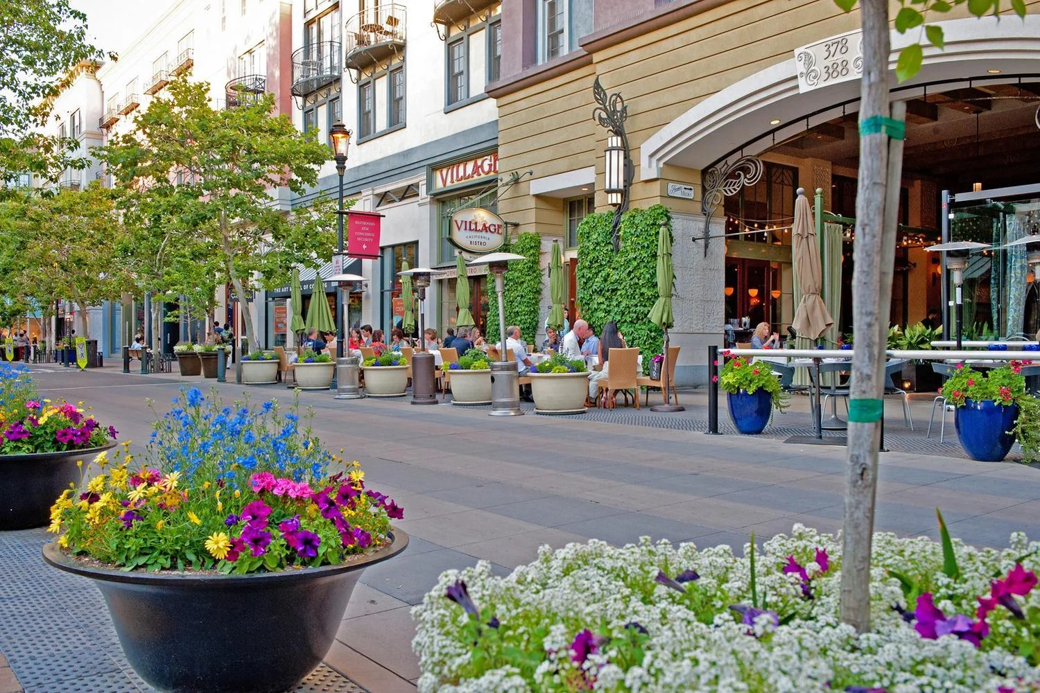
San Pedro Square in Downtown is a dining district within walking distance of Downtown light rail stations. Japantown, just north of Downtown, is an older district with a concentration of small restaurants and shops. Santana Row also has plenty of dining. In other areas, restaurants mostly line local commercial streets, such as Lincoln Ave in Willow Glen.
What buyers should know: Living near a commercial street is convenient, but pay attention to weekend and evening crowds, street parking and noise. If a home you're considering is very close to one, go back and see it on a weekend evening.
Representative districts
- San Pedro Square (Dining district): Downtown, around N San Pedro St. Walkable to Downtown light rail stations.
- Japantown (Neighborhood commercial street): North of Downtown, around Jackson St. Older district with a concentration of small restaurants and shops.
Parks and outdoors | Foothills, creek trails and family spots
Outdoor options fall into roughly three groups. The first is foothill parks on the east and west sides: Alum Rock Park to the east, Almaden Quicksilver County Park to the southwest and Santa Teresa County Park at the south end. They're good for hiking and biking, but plan for grades and summer sun. The second is flat creekside trails: Guadalupe River Park runs through Downtown, the Los Gatos Creek Trail connects Willow Glen, Campbell and Los Gatos, and the Coyote Creek Trail runs along the city's southeast side. These trails aren't continuous and have gaps, so if you'd like to use one for a bike commute, confirm it works for your start and end points. The third is city regional parks and kid-oriented attractions such as Lake Cunningham, the Municipal Rose Garden and Happy Hollow in Kelley Park.
What buyers should know: County park rules are listed on the County Parks website: Almaden Quicksilver has no entry fee, and Santa Teresa County Park charges a vehicle entry fee year-round. Parking fees, hours and temporary closures at city regional parks change, so check the city parks department website before you go.
Main parks and trails
- Almaden Quicksilver County Park (County park / trails): South end of Almaden Valley; main Hacienda entrance at 21785 Almaden Rd. County Parks information: more than 37 miles of hiking trails, plus equestrian and bike routes; no entry fee; dogs must be leashed; open daily from 8 a.m. to sunset. Official site
- Santa Teresa County Park (County park / trails): Santa Teresa; main entrance at 260 Bernal Rd. County Parks information: more than 17 miles of unpaved trails, steeper around Coyote Peak; vehicle entry fee year-round; the park has a golf course and an archery range. Official site
- Alum Rock Park (City regional park): East Foothills, off Alum Rock Ave and Penitencia Creek Rd. Foothill park in a canyon; check the city parks department website for parking fees and availability. Official site
- Guadalupe River Park (Riverside park / trail): Downtown, along the Guadalupe River. Riverside trail connects Downtown toward the airport.
- Los Gatos Creek Trail (Trail): Willow Glen to Campbell and Los Gatos. Paved trail connected in segments; not fully continuous at the Downtown end.
- Coyote Creek Trail (Trail): Along Coyote Creek, from the city's southeast side to its south end. Open in segments; check which sections are currently open before you go.
- Lake Cunningham Park (City regional park): Around Tully Rd and Capitol Expy, on the northern edge of Evergreen. Lakeside trail and sports facilities; check the city parks department website for parking fees. Official site
- Municipal Rose Garden (Park): Rose Garden area, around Naglee Ave. Rose garden and lawn surrounded by residential streets; street parking.
Libraries and community | A clue to daily life
The San José Public Library's location table lists 25 locations. The main library is the Dr. Martin Luther King, Jr. Library in Downtown (150 E San Fernando St), and the rest are spread across the city, including the Willow Glen, Almaden, Cambrian, Berryessa, Evergreen, West Valley, Rose Garden, Joyce Ellington, Vineland, Edenvale, Santa Teresa, Dr. Roberto Cruz Alum Rock and Alviso branches.
What buyers should know: Branches usually sit next to a park or community center, which makes them a good clue to where an area's daily life happens. While exploring, actually walk or drive to the nearest branch, noting how easy the crossings, parking and return trip are.
Libraries
- Dr. Martin Luther King, Jr. Library (Library (main library)): Downtown, 150 E San Fernando St. Main library of the San José Public Library. Official site
- San José Public Library branches (Library): Across the city; the official location table lists 25 in all. Look up the nearest branch and its hours by address. Official site
Transit and commuting | Test it door to door
Driving
Driving is the main way to get around in most areas, so when choosing an area, start with the freeway and on-ramp you'd use every day. To reach offices in North San Jose, Santa Clara and Sunnyvale, southern areas mostly take SR-87 or SR-85 to US-101 or SR-237, while eastern areas take I-680, Capitol Expy or Montague Expy. For Cupertino and Mountain View, take I-280 or SR-85. For the Peninsula, take US-101 or I-280. For Fremont and the Tri-Valley, take I-880 or I-680. Peak-hour backups vary widely at the freeway interchanges (101/280/680, 87/280, 85/87, 101/880), so check them separately using your own departure time.
Light rail and buses
VTA runs three light rail lines. The Blue Line goes from Santa Teresa through Downtown and along North First St to Baypointe. The Green Line goes from Winchester in Campbell through Diridon and Downtown to Old Ironsides in Santa Clara. The Orange Line goes from Alum Rock through Milpitas to Mountain View. Light rail serves a corridor, and few homes are within walking distance of a platform, so most riders need to drive, bike or take a bus to the station. VTA also runs several Rapid bus lines. Rapid 500 connects Diridon and Berryessa BART, and Rapid 522 links Palo Alto and Eastridge along the El Camino, Santa Clara St and Alum Rock corridor.
BART, Caltrain and the airport
BART currently has just one station in the city, Berryessa/North San José (1620 Berryessa Rd), which opened in 2020 along with the Milpitas station. It offers direct service toward Fremont, Oakland, downtown San Francisco and Richmond, and VTA operates its paid, first-come, first-served parking. Caltrain's main stations are San Jose Diridon and Tamien. Very few trains stop at College Park. Capitol and Blossom Hill are served only by South County Connector trains to and from Gilroy, with a small number of trains running north on weekday mornings and south in the early evening. ACE runs from Diridon toward the Tri-Valley and Stockton, and Capitol Corridor runs from Diridon toward Oakland, Sacramento and Auburn. San José Mineta International Airport (SJC) sits just north of Downtown and can be reached from most areas via SR-87 or I-880.
What buyers should know: how to test your commute
- In a map app, enter the home's address and the exact entrance of your office, then set the departure time to when you normally leave on a workday. Check Tuesday through Thursday, morning and evening, in both directions, and repeat the same route with two or three different departure times.
- If you plan to take BART, Caltrain or light rail, find your actual train on the official schedule first. Then work backward from the platform to your front door: how you'll get there, where you'll park, and whether parking costs money or requires a monthly pass.
- At stations with very limited service, such as Capitol, Blossom Hill and College Park, don't assume a nearby Caltrain station is useful. Go by the trains that actually stop there on the current schedule.
- If you have school drop-offs, map the whole home-school-office route. Congestion around a school at drop-off time often affects your day more than the freeway does.
Almaden Valley to North San Jose offices
The basic drive is north on Almaden Expy to SR-87, past Downtown and the airport, then onto US-101, North First St or SR-237 to reach the office park. Check the intersections on Almaden Expy around SR-85 and morning peak conditions on the stretch of SR-87 approaching I-280. If you'd like to use light rail, the Blue Line's Ohlone/Chynoweth station is near the SR-85/SR-87 interchange and continues along North First St to Tasman and Baypointe. You'll need to confirm parking near the station and the last leg from the stop to your office.
Berryessa to downtown San Francisco
From Berryessa/North San José station, direct trains toward Daly City run through Fremont and Oakland, then under the bay to the downtown San Francisco stations, with no transfer needed. Check how you'll get from home to the station (on foot, by bike, by VTA bus, or by driving and using VTA's paid parking), the first and last trains and the headways for your trip, and the walk from the station to your office.
West San Jose to Apple's Cupertino campus
The two areas are next to each other, so many people use surface streets such as Stevens Creek Blvd, Bollinger Rd, Lawrence Expy or De Anza Blvd, or take a short stretch of I-280. The biggest factors are backups near the I-280 ramps and at major intersections on Lawrence Expy and Wolfe Rd, plus which road your campus entrance is on. Whether biking works depends on whether the bike lanes are continuous along your actual route.
Evergreen to Milpitas or Fremont
Drivers generally leave via Capitol Expy, Tully Rd or Aborn Rd, then take US-101 north to I-680 or go straight up I-680. For south Fremont, I-880 is also worth comparing. Evergreen has no rail station, so taking transit means first getting to the Orange Line at Alum Rock or to Berryessa BART. Try that connection in person before you decide.
Official routes and schedules
Schools: verify by address
OverviewCoverageVerifyClosuresBuyer tipsLookups
School districts | One city, many districts
San Jose's city limits and school district boundaries don't line up at all. City planning documents alone list 17 districts by area: the unified San José Unified; the high school districts East Side Union, Campbell Union and Fremont Union; the elementary and middle school districts Alum Rock, Berryessa Union, Evergreen, Franklin-McKinley, Mt. Pleasant, Oak Grove, Cambrian, Union, Moreland, Campbell Union and Cupertino Union; and Santa Clara Unified and Morgan Hill Unified, which extend into the city. Two small districts, Orchard and Luther Burbank, are usually mentioned as well. The two sides of a street may belong to different districts, so "living in San Jose" doesn't tell you which school a child will attend.
A ZIP code is not a school boundary, and a neighborhood name does not tell you which school serves an address.
Main districts | Coverage
Here's the rough breakdown. The strip from Downtown through Willow Glen to Almaden Valley is San José Unified (TK–12). Most addresses in the east and south pair an elementary district with East Side Union HSD. Cambrian and the southern half of West San Jose mostly pair the Cambrian, Union, Moreland or Campbell Union elementary district with Campbell Union HSD. The part of West San Jose near Cupertino is in Cupertino Union (TK–8) and Fremont Union HSD (9–12, a South Bay high school district that is separate from Fremont Unified in the city of Fremont). Some North San Jose addresses are in Santa Clara Unified, and some addresses at the far south end, toward Coyote Valley, are in Morgan Hill Unified.
San José Unified School District (SJUSD) · TK–12
A long, narrow strip running south from Downtown through Willow Glen to Almaden Valley
The district offers separate address lookup tools for the 2026–27 school year and for 2027–28 and later. Results may differ, so use the one for the year your child will enroll. According to the district, when an attendance-area school is full at a given grade, a student may be placed at the nearest school with space and put on a waitlist; magnet schools aren't part of this placement.
East Side Union High School District (ESUHSD) · 9–12
Large parts of the east and south, including high schools for Berryessa, Alum Rock, Evergreen, Silver Creek, Edenvale, Santa Teresa and other areas
The district says its Attendance Area Locator is more accurate for addresses near a boundary. Transfers within the district are approved based on available space. Evergreen Valley, Piedmont Hills, Santa Teresa and Silver Creek are listed as impacted schools, and transfer requests into them are usually denied outright. For elementary and middle school, look up the separate elementary district.
Campbell Union High School District (CUHSD) · 9–12
High schools for Cambrian, the southern half of West San Jose and neighboring areas such as Campbell (Branham, Leigh, Prospect, Westmont, Del Mar and others)
High schools only. Elementary and middle schools belong to elementary districts such as Cambrian, Union, Moreland and Campbell Union, which need to be looked up separately.
Cupertino Union School District (CUSD) · TK–8
Some West San Jose addresses near Cupertino
Lookup results are a preliminary assignment; the final placement is whatever the district's Student Assignment office confirms.
Fremont Union High School District (FUHSD) · 9–12
High schools for the West San Jose addresses that overlap with Cupertino Union
A South Bay high school district, unrelated to Fremont Unified School District in the city of Fremont.
Santa Clara Unified School District (SCUSD) · TK–12
Some North San Jose addresses
North San Jose addresses may fall in several different districts, so always look up the exact street address.
Berryessa Union School District (BUSD) · TK–8
Elementary and middle schools in the Berryessa area; high schools are in East Side Union HSD
Three elementary schools closed starting in 2025–26, and attendance areas changed as a result. Confirm the school for a specific address with the district.
Evergreen School District (ESD) · TK–8
Elementary and middle schools around Evergreen and Silver Creek; high schools are in East Side Union HSD
The link on the district website is titled "What Is My School of Residence?"
Oak Grove School District (OGSD) · TK–8
Some addresses in the southern Blossom Valley, Santa Teresa and Edenvale areas; high schools are in East Side Union HSD
Union School District (USD) · K–8
Southeastern Cambrian and some addresses near Los Gatos; high schools are in Campbell Union HSD
The district website calls this tool the Find Your School Map Tool.
Cambrian School District (CSD) · TK–8
The central Cambrian area; high schools are in Campbell Union HSD
The district website also has Transfers, Lottery Information and Waiting List pages. See those pages for how to enroll in programs such as Steindorf STEAM Magnet School.
Moreland School District (MSD) · TK–8
Some addresses in the southern half of West San Jose; high schools are in Campbell Union HSD
Verify boundaries | Two steps
Step 1: Use the Santa Clara County Office of Education's School District Locator page, following its directions (through County Assessor parcel records), to find which district the address is in.
Step 2: Use that district's own address lookup tool to find the specific school.
Four boundaries not to confuse
City limits determine municipal services and city taxes. They do not map to school assignment.
District boundaries determine which school district an address belongs to.
Attendance boundaries determine which school normally serves an address, set separately by grade level.
Trustee areas are only for electing school board members. Do not use them to look up a school. Many districts elect board members by Trustee Area. These maps are used only for elections and have nothing to do with school attendance boundaries, so use the address lookup tools above to find a school.
Closures and changes | Check by enrollment year
Over the past two years, several districts have closed or merged schools because of falling enrollment. When buying, check for the school year your child will start that the school is still operating and its attendance area hasn't changed. The decisions made so far are listed below. Official district announcements control the details.
San José Unified
Decision: Board approved the Schools of Tomorrow plan on March 26, 2026.
Canoas, Empire Gardens, Gardner, Lowell and Terrell elementary schools close. May 29, 2026, is the last day of classes, and they no longer operate starting in 2026–27. The Hammer Montessori program moves to the Gardner campus starting in 2026–27.
Effective: Closures take effect in the 2026–27 school year; new attendance boundaries apply to incoming students starting in 2027–28, and the district offers separate address lookup tools for each phase.
Alum Rock Union
Decision: Board vote on December 2, 2024.
Sylvia Cassell, Horace Cureton, A.J. Dorsa and Donald Meyer elementary schools and Joseph George Middle School close. Renaissance Academy at Fischer merges into Renaissance Academy at Mathson, Ben Painter merges into Sheppard, and L.U.C.H.A. merges into San Antonio. Adelante I and Adelante II combine at the former Renaissance Academy at Fischer campus.
Effective: Most changes take effect in 2025–26; the Adelante merger takes effect in 2026–27.
Berryessa Union
Decision: Board vote on December 18, 2024.
Cherrywood, Toyon and Laneview elementary schools close, and attendance areas change as a result.
Effective: Takes effect in 2025–26.
Franklin-McKinley
Decision: Board vote on February 25, 2025.
Los Arboles, Ramblewood and McKinley close, with students reassigned to Bridges Academy, G.W. Hellyer, Lairon College Preparatory Academy, George Shirakawa Sr., Sylvandale, Santee and other schools.
Effective: At the time of the vote, the district said the closures would happen before the next school year, meaning starting in 2025–26.
Programs and choice schools | Living nearby is not enrollment
Your assigned school is determined by your address. Magnet, Montessori, dual immersion and alternative schools are choice programs that require a separate application and may use a lottery or waitlist, so living nearby doesn't mean a student can attend. At the high school level, East Side Union HSD approves transfers within the district based on available space, the application window for the new school year opens each year on March 1, and impacted schools generally don't accept transfers. Base your home decision on the assigned high school, and don't count on a transfer.
- San José Unified has magnet schools. Its directory includes River Glen K-8, Hacienda Science/Environmental Magnet and Hammer Montessori. Hammer Montessori moves to the Gardner campus starting in 2026–27.
- San José Unified's Transitional Kindergarten requires a child to turn 4 on or before September 1 of the enrollment year. Registration for the next school year opens in early December.
- East Side Union HSD high schools offer CTE pathways (the district calls them Magnet). The district says interest in a pathway doesn't mean a transfer request will be approved. Alternative schools such as Calero, Foothill, Apollo, Pegasus and Phoenix each have their own application requirements.
- Cambrian School District has Steindorf STEAM Magnet School and a separate Lottery Information page on its website.
- In its December 2024 consolidation plan, Alum Rock Union kept its English-Vietnamese dual immersion program, which moves with Ben Painter Elementary to the William Sheppard Middle School campus.
- Campbell Union School District and Moreland School District both list preschool programs on their websites. See the district pages for space and age requirements.
School data and routes | How to read them
Search for a district or school name on the California School Dashboard (caschooldashboard.org) to see academic performance, chronic absenteeism, suspension rates, English learner progress, graduation rates and other indicators, including results for different student groups. The Dashboard updates once a year, so check the report year shown on the page first, and use the same year when comparing districts. San Jose involves many districts, so look at the elementary and high school districts separately.
Open the California School Dashboard →
Evaluate the route to school for each specific school. Many San Jose schools sit next to expressways or four- to six-lane arterials, so try walking or biking the route from the home during school hours, and note the crossing signals, whether there's a crossing guard and which street the school entrance is on. The city's transportation department has walking and biking safety programs for schools. To find out whether a school participates or has a suggested route map, ask the school or the department.
Practical tips for buyers | Before you write an offer
- First pin down the school year your child will start, then use the tool for that year and look up the full street address. Results for the same address may differ from year to year.
- Look up the elementary and high school districts separately. Many addresses in the east, south and west of San Jose belong to different districts at these two levels.
- Base your decision on the assigned school, and don't count on a transfer, magnet or lottery program.
- School boundaries can change. A lookup result shows only the current arrangement and doesn't mean it will stay the same. The district's confirmation is what counts.
What sellers should know: In a listing, limit school information to the district and the official lookup links. Don't promise that an address goes to a particular school; ask buyers to confirm with the district using the full address and enrollment year.
Official lookups | By district
School boundaries and assignments can change. Confirm by full address and enrollment year with the district.
San Jose homes and what they cost to own
Home eras | What to check in older homes
San Jose's housing falls into rough rings by age. Downtown, Japantown, Rose Garden, Shasta-Hanchett and central Willow Glen keep many single-family homes from the first half of the 20th century. Wood frames, raised foundations and detached garages or no garage at all are common, and inspections should focus on foundations and seismic retrofitting, old wiring and pipes, roofs, and whether past additions were permitted. Cambrian, West San Jose, Blossom Valley and Berryessa are mainly single-story ranch homes from the 1950s to the 1970s, on regular lots and mostly with two-car garages. Common issues are original sewer lines, single-pane windows, and how recently the roof and HVAC have been updated. Some streets have Eichlers and other midcentury modern homes, whose flat roofs and radiant floor heating need a specialized inspection.
What sellers should know: When selling, gather the home's age, permit records for renovations and additions, and dates for roof, plumbing and wiring updates, since those are often the first things buyers and inspectors ask about. For a home with an HOA, have the monthly dues breakdown, reserve report and meeting minutes ready ahead of time.
Single-family homes | Age varies widely by area
Found in every area, with a wide range of ages. Homes around Downtown are mostly prewar. Cambrian, West San Jose, Berryessa and Blossom Valley are mostly single-story ranch homes from the 1950s to the 1970s, and parts of Evergreen, Silver Creek and Almaden have newer two-story homes. For older homes, focus on the foundation, plumbing and wiring, roof and addition permits. For hillside homes, also check drainage and retaining walls.
Townhomes | Stairs, garages and the HOA
Townhomes from the 1970s and 1980s are scattered through Blossom Valley, Berryessa, West San Jose and other areas. Newer three-story townhomes are concentrated in North San Jose, around Berryessa BART and on newer development sites in the south. The usual trade-off is more stairs, tandem garages and small yards in exchange for newer construction and systems. Read the HOA documents in full.
Condos | Parking, elevators and the HOA
Downtown has high-rise condos, while North San Jose and the area around Santana Row are mostly mid-rise. Verify parking rights, guest parking, elevator and common-area maintenance, what the monthly HOA dues cover, any pending litigation or special assessments, and any lender restrictions on the project.
Newer neighborhoods | Two-story homes and planned communities
Evergreen, Silver Creek, Santa Teresa and parts of Almaden Valley were developed from the 1980s on. Two-story homes are common, usually with the bedrooms upstairs, so if you need one-level living, check whether the first floor has a bedroom and a full bath. Newer planned communities often have HOAs. North San Jose, Downtown and the areas around rail stations hold most of the condos and townhomes built in the past 20 years or so. Things to check there include the number and layout of parking spaces (side by side or tandem), guest parking, flights of stairs, storage, and the HOA's dues and reserves.
Foothill homes | Extra checks on slopes
Hillside homes in the foothills (Almaden, Silver Creek, East Foothills) call for a few extra checks: retaining walls and drainage, driveway slope, geologic and wildfire zones, and whether you can readily get an insurance quote.
HOA and holding costs | Beyond the purchase price
Beyond the purchase price, ownership costs need to be calculated for the specific home. Property tax is based on the sale price. On top of the base rate set by California's Prop 13 come bonds and special assessments from the local school district, community college district and other agencies. Because San Jose spans many school districts, these add-ons vary by address. After closing, the county also sends a supplemental tax bill based on the difference between the old and new assessed values. Newer developments may have a Mello-Roos/Community Facilities District, and the only way to confirm whether one exists, how much it costs each year and when it ends is through the home's tax bill and title report.
Two factors are specific to San Jose. The first is electricity: most residents get their generation service by default from San José Clean Energy, which the city runs, while PG&E still handles transmission, distribution and billing. You can choose among several plans or opt out. The second is water: several different water providers serve different parts of the city. San Jose Water is a private utility regulated by the California Public Utilities Commission (CPUC), and the city's own Municipal Water System serves some areas. Rate structures differ, so confirm the provider by address.
San Jose's Measure E also imposes a city transfer tax on high-value real estate transfers. The threshold and tiered rates are adjusted periodically, so check the city's current tax table. Whether the buyer or seller pays is set in the contract. For insurance, get a quote before making an offer on any address in the foothills or near open space. Homes with a mortgage in a FEMA Special Flood Hazard Area usually need separate flood insurance.
What buyers should know: what to confirm for a specific home
- Ask the seller or title company for the most recent complete property tax bill, and go through every bond, special assessment and CFD/Mello-Roos item beyond the base tax.
- For homes with an HOA, request the breakdown of monthly dues, the reserve report and recent meeting minutes, and ask about any special assessments or pending litigation.
- Confirm the address's water provider and electricity plan, and how trash and sewer fees are billed (some are collected on the property tax bill).
- If the sale price may reach the Measure E threshold, ask the title company to estimate the transfer tax using the current table, and state in the contract who pays it.
- Get a homeowners insurance quote before making an offer. For foothill addresses, also ask about wildfire-related terms; for low-lying addresses, check flood insurance requirements.
- Estimate your monthly gas, bridge tolls, and station parking or pass costs for your commute, and weigh them alongside the price differences between areas.
Environment and noise | Check by address
San Jose has an inland valley climate, with hotter, sunnier summers and less fog than the bayside Peninsula cities. Alviso and North San Jose at the north end run a little cooler thanks to bay breezes, while Almaden and Santa Teresa to the south and Evergreen to the east get hotter in the afternoon. West-facing rooms, roof insulation and air conditioning matter more here than on the Peninsula.
Noise comes mainly from three sources. SJC airport sits right next to Downtown, and its flight paths pass over Downtown, Rose Garden, Japantown and neighborhoods in line with the runways to the north and south. The airport's Noise Office offers flight tracking (WebTrak) and a way to file complaints, and the airport has a nighttime curfew. On the rail side, Caltrain and freight trains run along the Monterey Rd corridor through Tamien, Edenvale and Blossom Hill and along Stockton Ave north of Diridon, while light rail runs along North First St, SR-87 and Capitol Ave. Freeway noise depends heavily on how high the home sits relative to the road and whether there's a sound wall, so go listen on site during both the morning and evening peaks.
Natural hazard maps need to be checked by address. Flooding: Coyote Creek flooded in February 2017, and the Guadalupe River corridor and low-lying Alviso are also areas to review on FEMA flood maps. Anderson Dam sits upstream in Morgan Hill. Because of seismic concerns, its reservoir has been held at a very low level since late 2020 as required by federal regulators. Valley Water awarded the seismic retrofit construction contract in July 2026, with work planned to start in early 2027 and last several years. Earthquakes: the Hayward and Calaveras fault systems run through the eastern foothills. California Geological Survey (CGS) maps show fault zones, liquefaction zones and landslide zones. Liquefaction zones are common on the valley floor, and landslide zones are common in Almaden and the eastern foothills. Wildfire: where the foothills meet open space, check CAL FIRE's Fire Hazard Severity Zone maps. New maps for local jurisdictions were released in stages from February to March 2025. These maps show what to investigate further; you can't infer how safe a particular house is from them alone.
- FEMA flood map (by address): Shows whether an address is in a FEMA Special Flood Hazard Area, which determines whether a lender requires flood insurance. Check any home along Coyote Creek or the Guadalupe River or in Alviso.
- Valley Water flood zone lookup: An address lookup from Santa Clara County's water agency, with flood preparedness resources. Compare it with the FEMA map.
- CGS EQ Zapp earthquake hazard zone lookup: Shows by address whether a property is in an Alquist-Priolo fault zone, a liquefaction zone or an earthquake-induced landslide zone. Worth checking for homes in the eastern foothills, around Almaden and on the valley floor.
- CAL FIRE fire hazard severity zone lookup: The state fire agency's Fire Hazard Severity Zone map. Check addresses near open space in Almaden, Silver Creek, the Evergreen foothills and East Foothills, and confirm with the city which version it has adopted locally.
- SJC airport noise and flight tracking: The airport Noise Office page, with WebTrak flight tracking and how to file a noise complaint. Homes in Downtown, Rose Garden, Japantown and in line with the runways can check actual flight tracks.
Nearby development | The long view
The project under construction with the biggest effect on daily life is BART Silicon Valley Phase II, which extends about six miles south and west from Berryessa/North San José station, with four stations, through Downtown and Diridon to Santa Clara. Materials on the VTA project website as of October 2026 list construction from 2024 to 2035, followed by system testing from 2035 to 2037 with a target of opening for service. In other words, buying near Downtown or Diridon today means living with construction fencing, lane changes and temporary parking closures for roughly the next decade. The benefits of service come later, and the schedule may still change.
The city's general plan, Envision San José 2040, steers new housing toward Downtown, North San Jose, the area around Diridon station and Urban Villages, which are mostly at rail stations, along major commercial streets and on former shopping center sites. For buyers, this means single-family streets near these locations are more likely to see mid- and high-rise apartments or commercial redevelopment nearby in the coming years, changing traffic and the look of the street. For a specific address, you can look up nearby applications and approved projects in the city planning department's permit search system.
Two changes to public services have already taken effect and are worth knowing about. The county has operated Regional Medical Center in the east since April 2025, and San José Unified's school consolidation took effect in 2026, with new attendance boundaries applying to incoming students starting in 2027–28. At the south end, the city and conservation agencies have been buying land in Coyote Valley in recent years to preserve it, positioning the area as open space rather than a new residential district.
BART Silicon Valley Phase II
As of October 2026: under construction; the VTA project website lists construction from 2024 to 2035 and system testing from 2035 to 2037 with a target of opening for service
Extends about six miles from Berryessa/North San José station with four stations, three of them underground, through Downtown and Diridon to Santa Clara, using a single-bore tunnel. Nearby streets will see fencing, detours and parking changes during construction, and some parking at Diridon station has already closed temporarily.
Official source
Anderson Dam seismic retrofit
As of October 2026: Valley Water awarded the construction contract on July 24, 2026, with work planned to start in January 2027; the related drainage tunnel work is expected to finish during 2026
Anderson Dam sits on upper Coyote Creek in Morgan Hill. The reservoir has been held at about 3% of capacity since late 2020, and it's closed to recreation during the work. The project affects long-term flood protection and water supply along lower Coyote Creek, including the stretch through San Jose, and the project schedule runs through fiscal year 2034.
Official source
San José Unified "Schools of Tomorrow" consolidation and boundary changes
Approved by the board on March 26, 2026; five elementary schools closed after the 2025–26 school year; new boundaries apply to incoming students starting in 2027–28
Empire Gardens, Lowell, Gardner, Canoas and Terrell elementary schools closed, and their students merged into Anne Darling, Washington, Horace Mann, Ernesto Galarza and Rachel Carson, respectively. Hammer Montessori moves to the Gardner campus. Students enrolled in 2026–27 can stay at their current school through the end of elementary school. Buyers around Downtown and Willow Glen should check both of the district's lookup tools.
Official source
Regional Medical Center becomes a county hospital
Taken over by Santa Clara County on April 1, 2025
Located at 225 N Jackson Ave. After the takeover, trauma, stroke and cardiac emergency services were restored, and the hospital is now part of Santa Clara Valley Healthcare. For eastern areas such as Alum Rock, Berryessa and Evergreen, it's one of the closest full-service emergency departments.
Official source
See San Jose homes for sale →